
Get Away for Less This Weekend with Hotwire!![]()

![]()
Up to 70% OFF hotels in Palm Springs!![]()
Want to help us with this website? You can!! You help us with the costs of this website when you follow the Orbitz and Hotwire links to book your Airfare, Hotel and Rental Car!! So please book your Hotel and Airfare with Orbitz or Hotwire by following links above, and help us continue to maintain and improve this website. You can book airfare, hotels, and rental cars right here and help us at the same time!!
Are you planning a hiking adventure in the Palm Springs area? The link below will take you to Amazon.com to enable you to purchase the Palm Springs area Hiking Bible, Philip Ferranti's 120 Great Hikes in and Near Palm Springs. I have my well used copy, and YOU should too!!
4.5 Miles Beginning elevation 340'
Difficulty: Strenuous Elevation Gain 2,300'
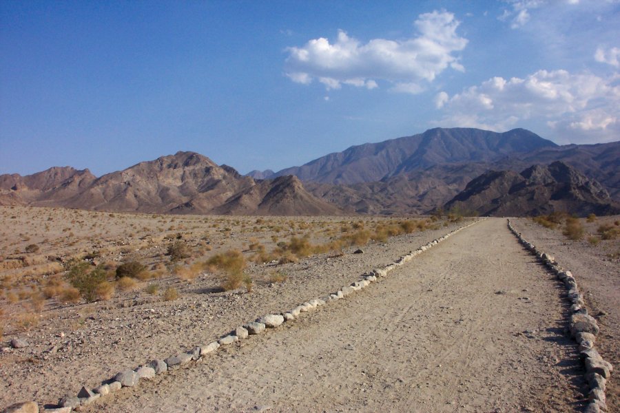
Directions: To reach the Bear Creek trailhead, take Highway 111 to La Quinta. At Washington Street, turn right. When you get to Eisenhower Drive, make a right turn and follow it until it ends at the top of the cove. Make a right onto Bermudas, and note that Bermudas becomes Calle Tecate. At the intersection of Calle Tecate and Avenida Ramirez there is a parking area in the dirt on the left. From the parking area follow the wide well marked trail to the "oasis" you will see up the trail to the right. The City of La Quinta has built a real nice hiking park in the area called " Oasis Cove ", and the trail leads to that. Keep walking past the "oasis" about 100 yards. There is a wash to the right, enter the wash, and turn south ( left ) and keep to the left for about 20 minutes ( give or take a few minutes, depending on how fast you walk... ). As you walk, the canyon will narrow. Look for a small canyon to the right that has black charred rock from camper's use. Not far past this canyon, at the Palo Verde tree, is the trail head that marks the beginning of Bear Creek Ridge Trail ( yes, there is even a sign that identifies it as such... ).
From here it is easy to follow the trail. This trail offers panoramic views in every direction. After about 2 miles on the trail, and on a clear day you can see the Salton Sea, and most of the Coachella Valley. The views of La Quinta and the hills and rocks of the area are beautiful. On this trail, you feel isolated from the hustle and bustle of the valley below.
As you continue to climb up this trail, the views get better and better. At the 4 mile mark, you will find a massive oasis tucked into the end of the canyon. This is where we ate lunch before starting back down the trail. This is about a 3 or 4 hour hike, and is rather Strenuous. If you haven't hiked much, or if you are out of shape, save this one until you have hiked some of the other trails on this web page.
![]() Click the hikers for
Hiking Tips .
Click the hikers for
Hiking Tips .
![]()
For tips on how much WATER you need click above.

Hiking Message Board
If you find this hiking information useful, and would like to use PayPal to help us with the costs of this website, you can donate any amount you want ( $1, or $5, or maybe $56,000 -- err aah, ok that may be a bit much, however any amount you want to send helps a lot . . . ) just by clicking the logo above! Please note this is not necessary or expected, but any amount helps us keep improving this Website ! !
Website designed and maintained By:  Computer Junkie, Indio, California.
![]() October 29, 2005
October 29, 2005 ![]()